BANDAISAN GEOPARK > D.Bandai Volcano Area
D.Bandai Volcano Area
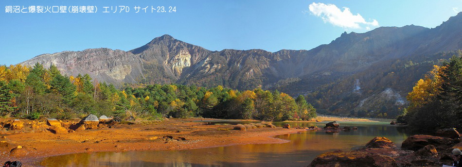
The central area of the Mount Bandai Geopark. The magnificent horseshoe shape crater that occurred by the main mountain body of the Bandai volcano and eruption of 1888
At the crater which I produced by eruption of 1888, I see alternated layers of volcano psephite, the lava making internal structure of the volcano particularly Mount Bandai very well.There is Akanuma- marsh in the center of the explosion crater.Emitting gas is still finished and can realize an active volcano in the south side of the marsh.What is discolored is to include a lot of iron content.Because it is a strong acid-related marsh, the fish cannot live.
By eruption of 1888, the north side of Mount Bandai became the steep crater wallSlope collapse was caused by a heavy rain of 1954 and fell apart in the north side, and the sediment formed most of the present Urabandai skiing areas.It is the happiness that the second disaster after the eruption gave to us.
Access About 40min. from JR Banetsusaisen Line Inawashiro station by Bus.
and working 60min.

|